-
Articles

Wild Camping in Switzerland 2024 :Enjoy the Thrills and Beauty
With its breathtaking Alpine scenery, tranquil lakes, dense forests and picture-perfect villages, Switzerland is a paradise for outdoor enthusiasts. One…
Read More » -
Camping Tips
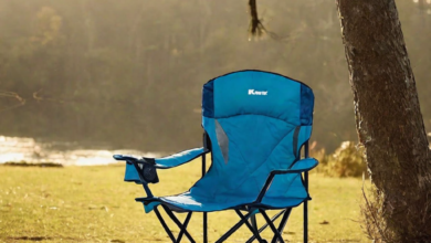
Kmart’s Range of Camping Chairs 2024
Camping trips allow you to get back to nature and make lasting memories with family and friends. But just because…
Read More » -
Articles

Eurocamp:the Magic of Italy 2024
Italy is a country renowned for its rich history, incredible food, stunning landscapes, and Mediterranean charm. For families looking to…
Read More » -
Camping Tricks

26 Best Weekend Getaways in Texas You Don’t Want To Miss
Are you ready to tick off an adventure to the iconic Lone Star state? Texas is huge in…
Read More » -
Camping Tips
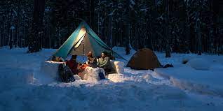
The Complete Guide to Winter Camping: Tips, Gear, and Advice for a Safe and Fun Trip
Winter camping,For outdoor enthusiasts, winter provides a unique opportunity to experience the serenity of the wilderness covered in snow. But…
Read More »